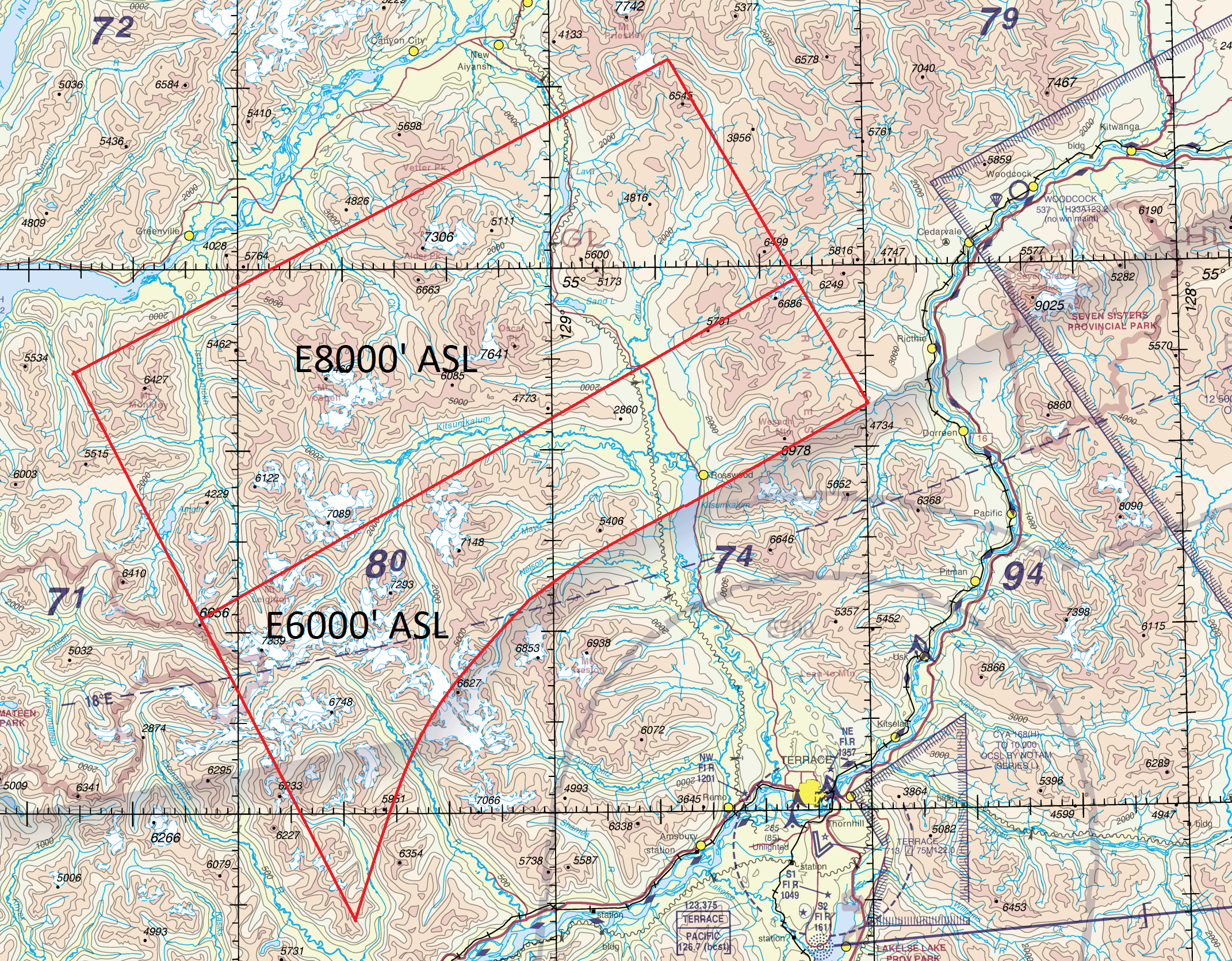


To contain recently published instrument approach procedures (IAP) at the Northwest Regional Airport in Terrace, British Columbia (CYXT), the creation of new Class E airspace north and west of the airport is required.
As a result, the areas described in the table and figure below will be designated as Class E Control Area Extensions. Their dimensions will appear in the Designated Airspace Handbook (TP 1820E), as shown below.
Terrace, BC:
The airspace from 6000´ above sea level (ASL) within the area bounded by a line beginning at:
N54°26'15.92" W129°17'15.59" to
N54°42'09.21" W129°32'21.71" to
N55°00'37.78" W128°33'39.32" to
N54°53'16.55" W128°26'48.90" to
N54°44'26.28" W128°55'15.72" thence counter-clockwise along the arc of a circle of
25 miles radius centred on
N54°22'26.43" W128°34'59.19" (Terrace, BC - NDB) \ to
N54°26'15.92" W129°17'15.59" point of beginning
The airspace from 8000´ ASL within the area bounded by a line beginning at:
N54°42'09.21" W129°32'21.71" to
N54°52'56.05" W129°42'44.36" to
N55°11'29.53" W128°43'50.84" to
N55°00'37.78" W128°33'39.32" to
N54°42'09.21" W129°32'21.71" point of beginning

NOT FOR NAVIGATION
These changes are planned to take effect 23 February 2023 at 0901 UTC. The appropriate aeronautical publications will be amended.